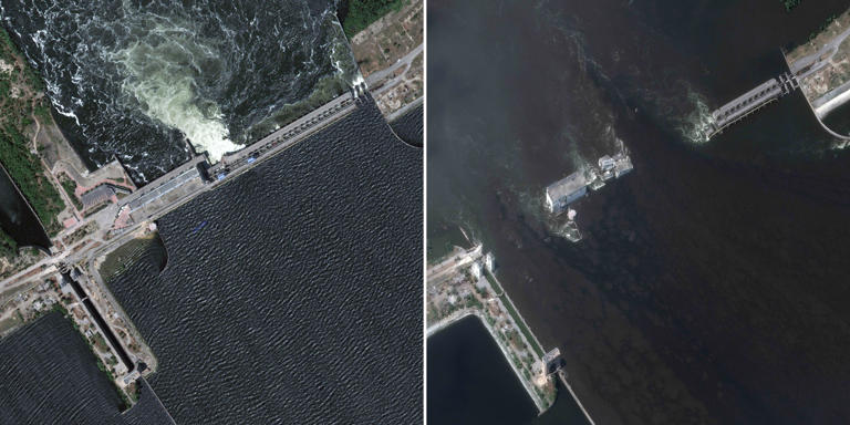


- The sheer scale of the destruction caused by the collapse of the Kakhovka dam was laid bare Thursday by new satellite images.
- Pictures from before and after the disaster — captured by Maxar Technologies, a U.S. defense contractor headquartered in Colorado — show how the landscape across southern Ukraine has been reshaped.
- The images underline the immediate challenge faced by emergency services to find and rescue stranded people, with entire communities underwater and thousands fleeing the surging Dnieper River.
Trending
Satellite Images Show The Scale Of The Ukraine Dam Destruction