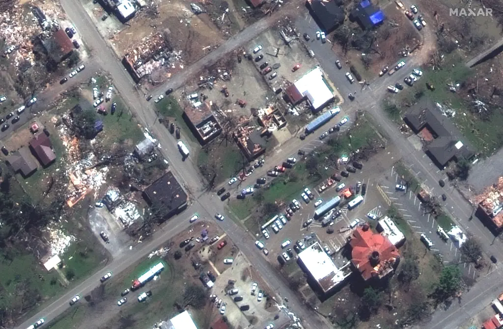


- Hair-raising satellite images exposed the scale of devastation in Mississippi after a deadly tornado ripped through Rolling Fork on Friday, sowing death and destruction in its wake.
- At least 26 people were killed and dozens were injured in Mississippi and Alabama when a monster storm, preliminarily rated as an EF-4 tornado, descended on the region.
- Rolling Fork — a predominantly black community of 2,000 residents located in one of the poorest counties in Mississippi — was among the hardest hit by the natural disaster, as seen in satellite images released by the space tech company Maxar on Sunday.
Trending
SEE IT: Shocking Satellite Pics Show MS Tornado Before And After Destruction